
 KSBY Community
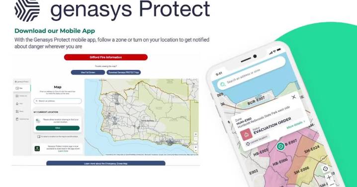
Santa Barbara County has launched a new emergency mapping tool to help residents determine their risk levels and evacuation zones during emergencies.
The interactive map allows residents to enter their address and receive critical information about potential evacuation orders and safety protocols tailored to their specific location.
"You can put in five addresses. Put in your home address, your work, an elderly parent's address or your child's school, if you want to know what might be impacting the places you live, visit and work," said Kelly Hubbard, Santa Barbara County Office of Emergency Management Director.
The mapping tool was launched in early August, coinciding with the massive Madre and Gifford fires that threatened the area this summer.
Residents can access the map through a

 KSNB Local4 Central Nebraska
 ABC11 WTVD
 Vogue
Vogue The Press-Enterprise
 MSNBC
MSNBC New York Post Entertainment