
 Spectrum Bay News 9 Technology
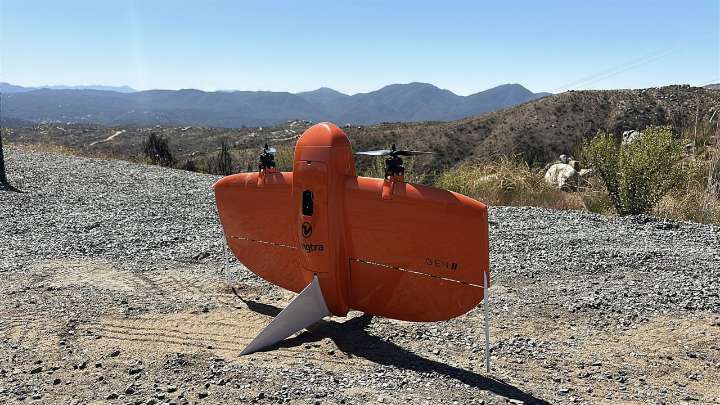
FULLTERTON, Calif. — Students at Fullerton College’s Drone Lab are taking their drone skills beyond the classroom, helping scan wildfire burn scars that could pose new risks of floods and landslides.
What You Need To Know • Students at Fullerton College’s Drone Lab are taking their skills to help scan burn scar areas from the Airport Fire • The drone-based LiDAR scanners create 3D maps that help fire officials pinpoint where terrain could be instable and identify areas vulnerable to landslides • Students are currently volunteering their time to get hands-on experience with the technology • The project in collaboration with the Orange County Fire Authority is still in its infancy, as they are hoping to get a full grant to further expand the work for more years
It’s a huge task stu

 KLCC
KLCC AmoMama
 CNN Video
 AlterNet
 The Daily Beast
 5 On Your Side Sports
 The Federick News-Post