
 New York Post
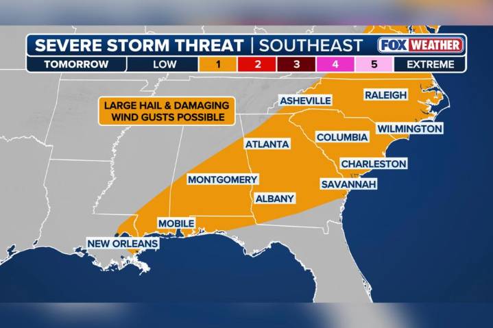
An advancing cold front is expected to spark widespread showers and thunderstorms from New England to the Gulf Coast on Thursday, with unsettled weather forecast to linger into Friday, according to the FOX Forecast Center.
While many of the storms that develop will be more isolated or of the pop-up variety, forecasters warn that a handful could reach strong to severe levels.
The greatest hazards will come in the form of damaging winds and torrential rainfall, which could be disruptive impacts to travel ahead of the frontal boundary.
“This boundary finds its way farther to the east, closer to the East Coast of the United States … with the flood potential, but also the outside chance for some strong and severe storms,” said FOX Weather meteorologist Ian Oliver.
Forecast models suggest

 WAVE 3 News
 Sarasota Herald-Tribune
 WSAZ NewsChannel 3
 WVLT
WVLT NBC Connecticut
 What's on Netflix
 Reuters US Top
 AlterNet