
 ClickOrlando
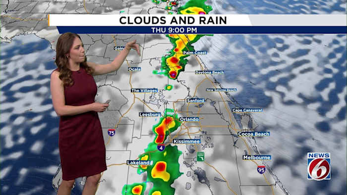
ORLANDO, Fla. – The tropics are showing signs of activity as we head into the weekend, all as a tropical wave near the southern Bahamas could drift closer to Florida by Monday.
Since the exact track and intensity forecast remains a bit uncertain, this is a system Floridians need to keep close tabs on through the weekend. Tropical Satellite
Invest 94L, regardless of exact path and strength, could bring impacts to our waters and coastlines by Saturday, with rough surf, choppy seas, beach erosion and a high risk of rip currents. Wave Heights
THURSDAY & FRIDAY
Expect a later start to scattered showers and a few storms early evening into the overnight. The collision of the sea breezes may spark isolated stronger storms as many head to bed Thursday night, bringing lightning, gusty win

 Breitbart News
 FOX 13 Tampa Bay Crime
 NBC News
 WESH 2 News
 Blaze Media
 Washington Examiner
  The Fashion Spot