
 Eyewitness News 3
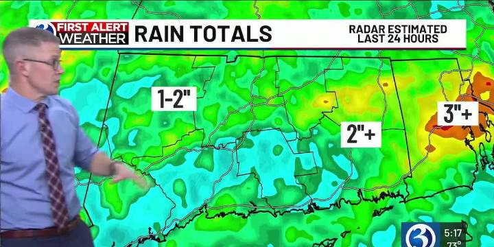
For any Alerts in effect for CT, click: here .
THIS EVENING, TONIGHT...
Our *First Alert Weather Day* continues this evening, due to another round of rain that could be heavy with embedded storms. This batch will move through CT between 7 and 11p, from west to east in advance of a cold front. We’re still in the level 1 risk from the Storm Prediction Center encompasses the entire state, for strong to severe storms. While gusty wind is primary concern, the overall threat diminishes by midnight. Thereafter, expect partial clearing and for areas of fog to develop as temperatures bottom out in the low to mid-60s.
TOMORROW…
In the wake of a cold front that will be moving offshore around daybreak, we’ll see increasing sunshine and feel a decrease in humidity during our Friday. It will be wa

 America News
 FOX 51 Gainesville Crime
 KGNS
KGNS AlterNet
 ABC News Video
 The Babylon Bee