
 WKYC Cleveland
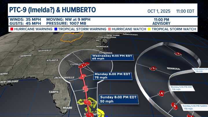
CLEVELAND — All eyes are watching the southwestern Atlantic Ocean tonight, as one hurricane and one potential tropical cyclone will team up to bring complications to the forecast for early next week across the southeastern coast of the United States.
Credit: #3weatherimpact
A National Oceanic and Atmospheric Administration P-3 Hurricane Hunter aircraft flew a reconnaissance mission Thursday evening, providing critical data on a developing weather system near Cuba. Dropsonde readings and surface reports indicate the system remains a broad trough of low pressure, with winds near 35 mph and pressure slightly falling to 1007 mb.
The disturbance is moving northwest at around 9 mph and is forecast to turn north-northwest by Saturday, tracking slowly along the southeastern U.S. coast. Foreca

 FOX19 NOW
 America News
 Raw Story
 AlterNet
 Simple Flying
 The Daily Mining Gazette
 The Daily Beast
 Rockford Register Star Sports