
 Republic World
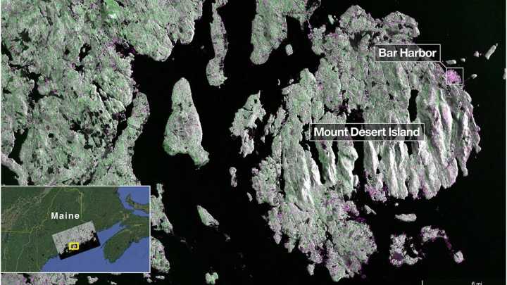
Show Quick Read Summary is AI-generated, newsroom-reviewed
The NASA-ISRO Synthetic Aperture Radar (NISAR) satellite has successfully sent its first radar images of Earth’s surface, marking an important step in the joint mission between NASA (National Aeronautics and Space Administration) and ISRO (Indian Space Research Organisation). The mission aims to provide detailed information about our planet and support various scientific and practical applications.
Launched by ISRO on July 30, 2025, NISAR uses advanced radar technology to capture images of Earth’s surface with high precision. On August 21, the satellite’s L-band radar system, developed by NASA’s Jet Propulsion Laboratory, captured images of Mount Desert Island on the Maine coast. In the images, dark areas represent water, green

 Bolavip Baseball
 ESPN Golf Headlines
 The Daily Bonnet
 AlterNet
 Voice of Alexandria Sports
 Best Life
 Crooks and Liars
 The Hill Politics
 The Daily Beast