
 WWSB
WWSB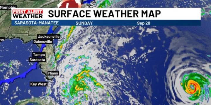
SARASOTA, Fla. (WWSB) - A weak weather pattern is setting up over the eastern U.S. as an Atlantic cyclone moves north-northwest across the central and northwest Bahamas. The system is expected to travel parallel to Florida’s east coast into early next week. That might possibly bring minor tropical storm winds to the Atlantic coastline of Florida.
While satellite images may appear concerning, the storm is forecast to remain well offshore. The main local effects will be breezy conditions and scattered showers, with a few non-severe thunderstorms possible today into Monday, especially inland.
As the storm tracks past the northeast Florida coast, winds will turn from the north and northwest, bringing in much drier air. This will quickly reduce rain chances starting Monday. By midweek, the on

 Law & Crime
 FOX 13 Tampa Bay Crime
 FOX 51 Gainesville Crime
 The Traverse City Record-Eagle
 WPTV West Plam Beach
 First Coast News
 The Atlantic