
 ClickOrlando
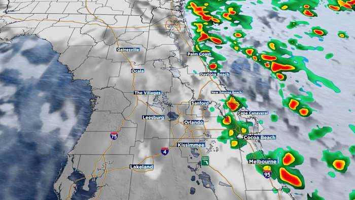
ORLANDO, Fla. – Central Florida will remain in a soupy and at times gray weather pattern for the next several days.
While Imelda will remain out-to-sea, tropical downpours generated by its stiff northeast breeze will continue through midweek. Future radar
The highest rain chances will be east of I-4. While the rain may be heavy at times, they shouldn’t last long. Future radar
Dangerous beach conditions will also be around through at least Thursday. Beach impacts
They will gradually improve for the upcoming weekend, but the rip current risk may still be elevated.

 The Augusta Chronicle
 FOX Weather
 KCRA News
 FOX 35 Orlando
 Lake & Sumter Style Magazine
 WWSB
WWSB @MSNBC Video
 The Daily Beast
 The List
 US Magazine
 Raw Story
 FOX 5 Atlanta Crime