
 Florida Today
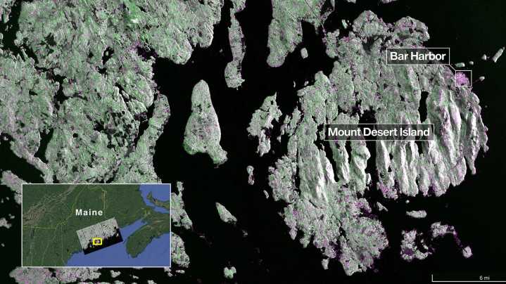
The NISAR mission is a joint venture between NASA and the Indian Space Research Organization (ISRO.)
The satellite, which launched July 30 from India, is designed to observe and map Earth in detail to provide scientists with measurements of some of the planet's most complex processes.
From there, decision-makers can use data to inform things like disaster response plans and agricultural management.
An Earth-observing radar satellite launched jointly between the U.S. and India has returned its first images of our planet’s surface.
The two radar images, captured in August by the as part of the NISAR mission, detail portions of both Maine's coast and North Dakota. In a late-September , said the photos serve as a glimpse of just what the advanced observatory will be able to capture from as

 Orlando Sentinel
 ScienceAlert en Español
 The Daily Beast
 The Hill
 Reason Magazine
 AlterNet
 WFMJ-TV Sports