
 SouthCoastToday
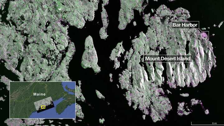
The NISAR mission is a joint venture between NASA and the Indian Space Research Organization (ISRO.)
The satellite, which launched July 30 from India, is designed to observe and map Earth in detail to provide scientists with measurements of some of the planet's most complex processes.
From there, decision-makers can use data to inform things like disaster response plans and agricultural management.
A new NASA Earth-observing satellite featured Maine’s coast in its first radar image .
The satellite, which was launched July 30, took the image of Maine on Aug. 21. It shows Mount Desert Island, an island off the north-central coast of Maine that's home to Acadia National Park .
Dark areas represent water, while green areas indicate forests. Some spots in the image are also mag

 WKOW 27
 Ocala Star-Banner
 IFL Science
 KPIX 5
 El Paso Times
 Raw Story
 NBC4 Washington
 America News
 The Daily Beast
 The US Sun Entertainment