
 News 19 WLTX
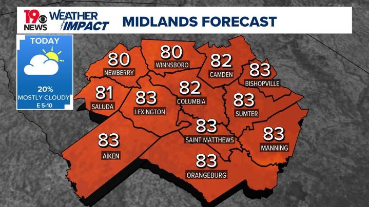
COLUMBIA, S.C. — A few isolated to scattered showers are possible today, mainly along and south of the I-26 corridor. Temperatures will be near to slightly above normal to start the week as high pressure and upper-level ridging remain in place.
The next significant chance for rain arrives mid-week as a cold front moves through the area, bringing a reinforcing shot of cooler, drier air to end the week.
Today, moist air flowing in from the Atlantic will keep the southern Midlands more humid, increasing the chance for showers in those areas. An isolated thunderstorm cannot be ruled out. A mix of sun and clouds is expected, and afternoon highs will reach the lower 80s.
Tonight, some mid-level dry air will move in, but low-level moisture will remain. After a bit of evening clearing, clouds

 KY3
KY3 FOX Carolina
 Cola Daily
 Raw Story
 The Daily Beast
 America News
 NBC News NFL
 Hollywood Life