
 WSAZ NewsChannel 3
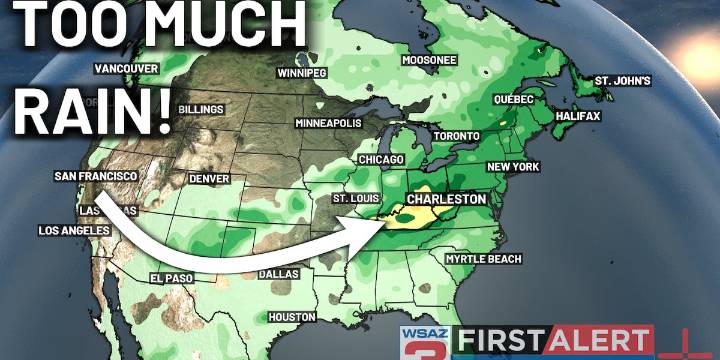
HUNTINGTON, W.Va. (WSAZ) - The hot and dry weekend we saw is no more.
Low pressure to the west will begin driving the development of rain shower activity over the region.
The first round of rain should begin tonight, mainly in areas north of the Ohio River/I-64.
These showers are expected to begin as light rain, but eventually will become heavier as we head through the night.
The heaviest rain will occur around dawn tomorrow morning, with areas near or just north of US-50 seeing higher chances of heavier rains.
By tomorrow evening, we’ll be looking at the development of heavier rain further to the south, in portions of eastern KY and central WV.
This heavier rain should continue to work its way slowly to the south and east, exiting the region by Wednesday morning.
Clear conditions a

 GV Wire
 Eyewitness News 3
 WWSB
WWSB KY3
KY3 Battle Creek Enquirer
 KBTX News 3
 KOMU 8
 Fox 26 Liberty County
 WRCB-TV
 NewsTalk 1280