
 Click2Houston
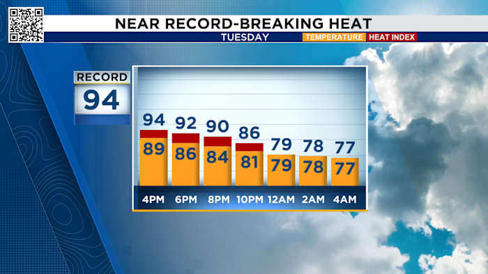
Tuesday’s forecast will be much like Monday’s forecast: hot, near record-breaking humidity with a chance for more rain in the afternoon into the evening.
You can track radar here:
Tuesday Forecast:
Temperatures climb to near-record levels over the next several days, with highs landing between 92 and 94 degrees through midweek.
Record highs for these dates have stood at 94, 95, and 96 degrees since 1928, 1956, and 1962. While it’s not expected that Houston will break any records, it’s shaping up to be remarkably warm, even for early fall.
The good news is that a cool front is headed our way midweek and will drop our morning lows into the 60s.
Tracking the tropics:
Tropical storm Jerry could form at any time, and I think it will be our next hurricane.
Longrange forecasts show it wi

 KWTX News 10
 KBTX News 3
 Fox 26 Liberty County
 FOX 4 News Arlington
 NBC News
 Amarillo Globe-News
 101.5 KNUE
 FOX 7 Travis County
 The Babylon Bee