
 ClickOrlando
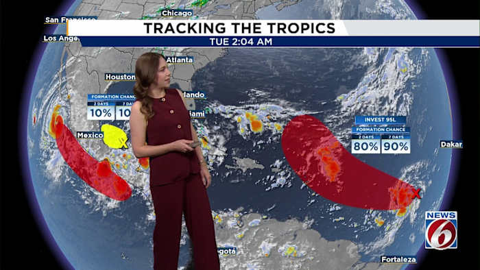
ORLANDO, Fla. – A weather system dubbed Invest 95L, about 1,500 miles east of the Windward Islands, is showing signs of getting stronger.
There’s a high chance it could become a tropical depression or a tropical storm in the next day or so as it moves quickly to the west-northwest. No description found
Chance of formation in the next 48 hours: 80%
Chance of formation in the next 7 days: 90%
The invest is expected to be near or just north of the northern Leeward Islands by Thursday and Friday before curving back into the central Atlantic.
It is not expected to have a direct impact on Florida. No description found
Meanwhile, in the southwestern Gulf, near the Yucatán Peninsula, a separate system is creating a broad area of disorganized showers and thunderstorms affecting northern

 Orlando Sentinel
 AP Breaking News
 WWSB
WWSB FOX 13 Tampa Bay Crime
 Florida Today
 WPTV West Plam Beach
 Raw Story