
 ABC4 News
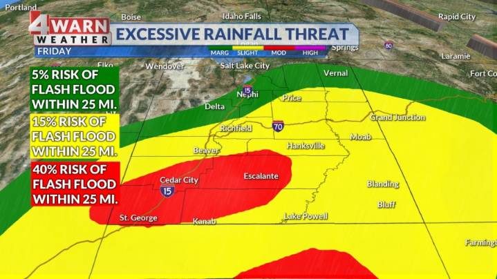
SALT LAKE CITY (ABC4) — Happy Friday, Utah! Periods of showers and storms will continue to move from southwest to northeast across the state through Saturday morning. The heaviest rain and associated biggest flood risk will be for areas south of I-70 across south and eastern Utah. The flash flood threat for popular recreation areas in Southern Utah is up at a probable risk for places like Bryce Canyon, Capitol Reef, Arches and Canyonlands. A "Flood Watch" remains in effect for Central, Eastern and Southern Utah through Saturday evening. Heavy rain will once again lead to flooding to low lying areas, normally dry washes, slot canyons and burn scars.
By the weekend, with above average moisture in place, we will see scattered storms and periods of precipitation. There's an upper-level low fr

 KSL Utah
 Santa Maria Times Local
 New York Post
 WSVN 7 News
 WITN-TV
 AccuWeather Severe Weather
 WSIL-TV
 WAND TV
 Raw Story
 AlterNet