
 KPAX
KPAX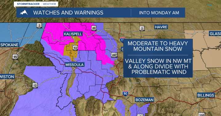
MISSOULA — A potent push of Pacific moisture will move in late Saturday night into early Monday. At the same time, a very cold airmass will spill southward out of Canada & interact with that moisture (along with wind) causing our first significant system of the season!
Here are the specifics:
The primary period of concern for winter travel impacts over mountain passes begins Saturday evening along the Divide (Marias Pass) and spreads westwards Sunday through Monday morning. Valleys in northwest Montana could face a dual threat: slick conditions during the initial rain-to-snow transition Sunday morning, followed by accumulating snow and icy conditions for the Monday morning commute. By Monday morning, accumulating snow and difficult travel are expected to become more widespread, including

 America News
 Denver7 News
 The Washington Post
 Newsday
 CBS Sacramento Dixon News
 WFTV Channel 9
 TMJ4 News
 WMTV NBC15
 NECN Providence
 Raw Story