
 Tucson News Now
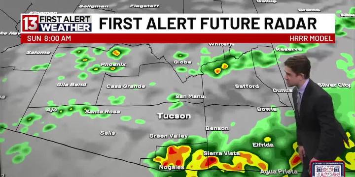
TUCSON, Ariz. (13 News) – Today is the first of 3-straight First Alert Weather Days through Monday, with flooding being the biggest threat. The region-wide flood watch continues through Monday afternoon. Scattered showers and storms will be present through this evening, with severe potential. A similar pattern is anticipated tomorrow, with a touch more storm & shower action in the High Valleys to the south & east. The flood & storm threat continues through Monday, with an uptick in winds to start the workweek. We really begin to dry out by Tuesday.
Today also ushers in a cooler period, with temps topping out in the low-to-mid 80s through the foreseeable future. You can’t rule out only topping out in the upper 70s tomorrow & Monday, as well as by later this upcoming week.
Tucson’s 7-Day F

 WBRC
WBRC WSAZ NewsChannel 3
 America News
 US Magazine
 Raw Story
 The Daily Beast
 AlterNet