
 ClickOrlando
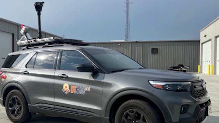
SEMINOLE COUNTY, Fla. – If you’ve spotted a car with cameras mounted on top driving through your neighborhood lately, it’s not from Google Maps. It’s part of a new statewide effort to prepare for natural disasters before they strike.
The high-tech vehicle, operated by the company DebrisTech, is scanning and mapping every mile of roadway and bridges across Florida. County officials said the goal is to document current conditions, creating a “before” picture that can be compared to damage after hurricanes or floods.
“This vehicle takes scans of the roadways, the bridges, all throughout the entire state of Florida,” said Alan Harris, director of Seminole County Emergency Management. “It helps us with damage assessment immediately after a disaster. Now we’re going to have pre-disaster pictu

 WCAX 3 Burlinton
 Associated Press US and World News Video
 The Babylon Bee
 Cover Media
 Raw Story
 America News
 New York Post
 OK Magazine
 ABC30 Fresno Sports