
 KETK
KETK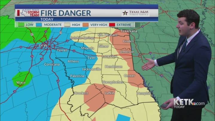
DISCUSSION: Above-normal temperatures will continue today as highs climb into the upper 80s to near 90. Fire danger will be elevated today and will continue to be through the end of the week. By this weekend, particularly on Saturday, showers and storms will return to the forecast. There will also be a risk for some stronger storms. It still appears that the best rain chances will be during the second half of the day on Saturday. After the cold front passes through, highs will be cooler on Sunday with low humidity.
TODAY: Mostly sunny skies. Highs in the upper 80s. Winds E at 5-10 mph.
TONIGHT: Mostly clear skies. Lows near 60. Winds E at 5 mph.
THURSDAY: Partly cloudy skies. Highs in the upper 80s. Lows in the mid 60s. Winds SE at 5-10 mph.
FRIDAY: Partly cloudy skies. Highs in the up

 WSIL-TV
 WWSB
WWSB KTAB
KTAB FOX 32 Chicago
 WAFB
WAFB NBC 7 San Diego Local
 Arizona's Family
 WEVV 44News
 AccuWeather Severe Weather
 KXLY 4 News
 MPR News Politics