
 WGCU Public Media
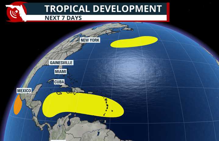
Even though the calendar says it is mid-October, the National Hurricane Center is monitoring two separate disturbances across the Atlantic basin, including a feature that will enter the Caribbean Sea next week.
Of the two disturbances, forecasters are closely watching the feature in the central Atlantic due to its longer-term potential.
The tropical wave is located east of the Windward Islands and is moving westward at a pace of 15 to 20 mph.
By next week, development chances are expected to rise, and the basin could see its next named storm — Melissa — develop south of Puerto Rico.
The Caribbean Sea is often a late-season hotspot for development, as water temperatures are sufficiently warm to support a tropical cyclone and there are periods of favorable upper-level winds.
Major compu

 ClickOrlando
 WESH 2 News
 Local News in New York
 NBC News
 CNN
CNN AlterNet
 Gainesville Sun Sports
 FOX News
 ABC 7 Chicago Sports