
 WKOW 27
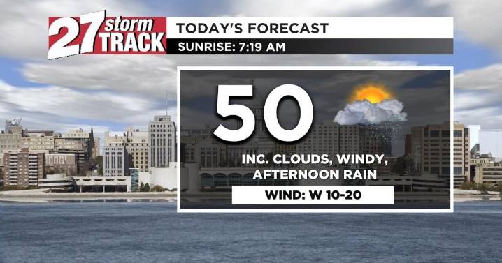
Download the 27 StormTrack Weather app to receive mobile weather alerts
Our Tuesday starts off dry and in the 40s, with temperatures not climbing much from there. Thanks to yesterday's cold front, today's highs only reach the upper-40s and low-50s. That high temperature comes fairly early in the day, thanks to afternoon rain cooling us off for the rest of the day. That rainfall takes over all of southern Wisconsin by around 2:00 p.m., sticking around through the evening and drying up early Wednesday. Once the rain is done, we'll have gotten an additional 0.1-0.2" of rain.
We're also looking at a windy day, with westerly winds moving in at 10-20 mph and gusts up to 30 mph. These windy conditions continue for the next couple of days, but by the end of the week, winds will be a lot calmer.

 LEX 18 News
 WRBL News 3
 Associated Press Top News
 KBTX News 3
 PennLive Pa. Politics
 NewsTalk 1280
 Sarasota Herald-Tribune
 Denver7 News
 WCVB-TV Boston
 KETV Politics