
 21Alive News
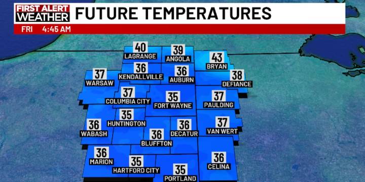
FORT WAYNE, Ind. (WPTA) - The wind has been relentless the past several days, but it’s on its way out. Of course, we rarely go from 35 mph gusts to nothing at all!
Thursday will be our “transition day” as wind gusts relax into the 15-25 mph range. It will also be partly to mostly cloudy with lake-effect rain showers most likely north of Fort Wayne. In fact, closer to Steuben County, 0.25-0.50″ of rain is possible! Everywhere else will experience sprinkles/light rain with highs in the low 50s.
Once we clear out late Thursday, temperatures will drop pretty quickly! Lows overnight into Friday morning will settle into the low to mid 30s, meaning another round of frost is expected. Friday will be mostly sunny with highs in the mid 50s, followed by another frosty night with lows back in the lo

 Hawaii News Now
 Bozeman Daily Chronicle