
 WSIL-TV
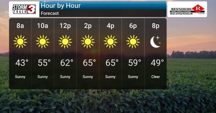
Today will be sunny and pleasant with highs in the 60s. We're on the tail end of a colder pattern, and conditions continue to be supportive of widespread frost across the northern and eastern parts of our region Friday morning, with temperatures dipping potentially close to freezing in a few spots.
Looking ahead, the weather pattern is poised for a shift. We're expecting primarily dry conditions through Saturday. However, we are watching for an increase in rain chances starting Saturday night and continuing into Sunday, and even into early to mid-next week.
Models suggest a trough of low pressure will dig across the eastern U.S. by mid-to-late next week. This could lead to a period of showers, and possibly even some thunderstorms, for our region, with Monday night through Tuesday night l

 KWQC
KWQC CBS4 Indy
 WEVV 44News
 KRIS 6 News Weather
 FOX Weather
 The Daily Bonnet
 Tampa Bay Times Health
 The Babylon Bee
 AlterNet
 Fortune
 CNN
CNN