
 Idaho News 6
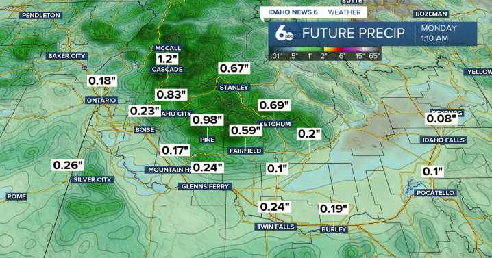
Good Friday Morning! Get ready to grab the umbrellas this weekend.
Today will be the last mild and dry day before a strong system out of the Gulf of Alaska pushes into the region this weekend. A cold front will arrive Saturday, bringing widespread precipitation, gusty winds, and much cooler temperatures. The heaviest moisture will fall north of the Snake Basin, where 1 to 2 inches of total liquid precipitation is expected — translating to several inches of snow at higher elevations. Elsewhere, amounts will range from about a third to two-thirds of an inch, with locally higher totals in the mountains.
Idaho News 6
Winds will be strongest Saturday afternoon and evening across southeast Oregon and the Owyhee Mountains, where gusts may reach 50 mph, prompting Wind Advisories in parts of Har

 WEVV 44News
 KRIS 6 News Weather
 FOX Weather
 Dakota News Now Sports
 Essentiallysports Motorsports
 AlterNet
 Raw Story
 America News