
 ClickOrlando
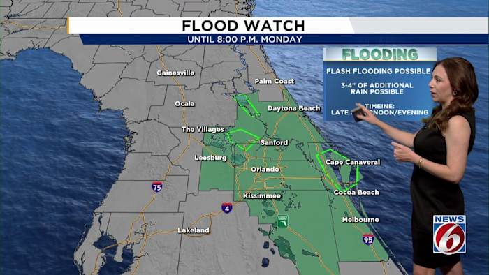
ORLANDO, Fla. – It’s going to be an active weather day in Central Florida, with additional downpours returning to the region.
MONDAY
An approaching cold front to our north and Hurricane Melissa to our south will keep the area in an unsettled pattern for one more day.
This warm and soggy setup will fuel scattered to numerous showers and thunderstorms through the Monday afternoon and evening. Embedded in this activity, some cells could be strong with gusty winds, small hail and pockets of heavy rain.
[VIDEO BELOW: Heavy rain slams Titusville]
While we’re not expecting the extreme rainfall totals seen in parts of north Lake and north Brevard Sunday night, localized flooding is still possible, and a Flood Watch remains in effect until 8 p.m.
Highs will reach the mid-80s, with “feels l

 Law & Crime
 Orlando Sentinel
 WWSB
WWSB People Crime
 WESH 2 News
 The Babylon Bee
 FOX 35 Orlando
 News4JAX
 AlterNet