
 ABC4 News
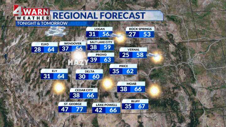
SALT LAKE CITY (ABC4) — Happy Thursday, Utah! After a chilly start to the work week, a ridge of high pressure is taking control of the West, and here in Utah, we get daytime highs to bounce back closer to seasonal averages.
Daytime highs are typically in the upper 50s and low 60s this time of year, with St. George in the low 70s. You can expect the Wasatch Front to see temperatures climbing into the upper 50s and low 60s today. We will see dry skies statewide, but you can also expect hazy sunshine. Even though a weak cold front moved through Northern Utah Wednesday, we could still see some haze hold on.
It's been a while since haze has settled into our valleys, but Inversion Season is back for the Wasatch Front. This area of high pressure that's building allows for a layer of warm air to

 Deseret News
 FOX News
 Raw Story
 The Babylon Bee