
 ABC News Canberra
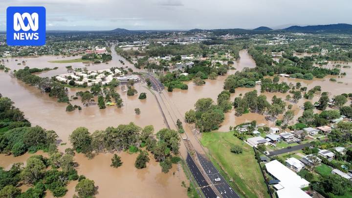
A south-east Queensland council has commissioned an independent review of its flood zone mapping modelling after receiving thousands of complaints about the plan.
The Logan City Council's flood map changes formed part of the updated draft Logan Plan — the city's planning scheme.
It mapped up to a one-in-2,000 annual chance flood event, or a 0.05 per cent chance of happening each year — per state government requirements.
"These are such rare and extreme floods that we've never seen them in Queensland's recorded history," Mayor John Raven told a special meeting of the council on Wednesday.
Several residents have spoken to the ABC about how mapping showed their property having a history of being inundated during floods, despite never experiencing that themselves.
Others had concerns ab

 AlterNet
 5 On Your Side Sports
 Raw Story
 TIME
TIME Women's Wear Daily Retail
 The Daily Beast
 ESPN Cricket Headlines