
 Lehigh Valley Live
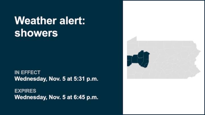
A report from the National Weather Service was issued on Wednesday at 5:31 p.m. for thunderstorms and showers with gusty winds until 6:45 p.m. for Higher Elevations of Indiana as well as Lawrence, Butler, Clarion, Jefferson, Beaver, Armstrong and Indiana counties.
"At 5:30 p.m., a line of showers with a couple of embedded thunderstorms extended from New Castle to Clarion in southwest Pennsylvania, ahead of advancing cold front. The line was moving east- southeast at 50 MPH, and will impact many areas north of Pittsburgh through 6:30 p.m. Along with brief heavy rain, gusts of 45 to 55 MPH will be possible in the stronger showers and storms along this line. These wind gusts could cause some tree damage, as well as isolated power outages. Remain inside a sturdy structure when this line appro

 Eyewitness News 3
 KSL Utah
 Gothamist
 MyNorthwest
 The Daily Beast
 CBS Evening News
 Raw Story
 Wheeling Intelligencer
 5 On Your Side Sports