
 News Radio 690 KTSM
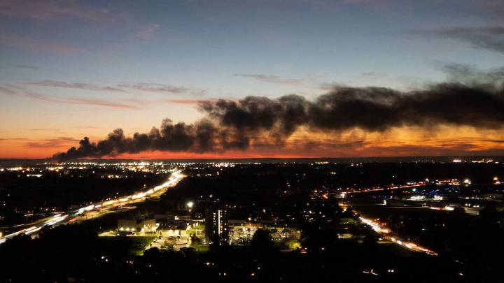
Satellite images revealed the path of destruction after the deadly UPS cargo plane crash at Muhammad Ali International Airport in Louisville on Tuesday (November 4), the New York Post reports.
Before-and-after shots captured by the satellite and data intelligence company Vantor showed a long black trail of debris and torched vehicles south of the airport, as well as a 300-foot gash on top of a UPS warehouse struck by the plane as it came down just after takeoff from the airport, which serves as the global shipping company's aviation hub. The crash sparked a massive inferno that engulfed the plane, which was carrying 50,000 gallons of fuel at the time of takeoff.
At least 12 people , including a young child, were killed after the UPS cargo plane erupted into a fireball on Tuesday,

 WLKY
WLKY WLWT
WLWT America News
 Reuters US Domestic
 FOX 5 Atlanta Crime
 Associated Press US and World News Video
 CBS News
 People Human Interest
 STAT News
 Law & Crime
 Essentiallysports College Sports