
 Yahoo Canada
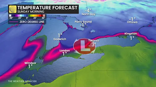
Southern Ontario is bracing for an active weather pattern heading into the weekend. All eyes are on a developing storm expected to move into the Great Lakes region on Sunday, potentially bringing a mix of precipitation to the area.
North of the storm track, substantial wet snowfall is anticipated, with accumulations surpassing 10 cm in areas such as cottage country, Haliburton, and regions east of Lake Huron and Georgian Bay. Meanwhile, areas near and south of the track, including parts of the Greater Toronto Area (GTA), could see a rain-and-snow mix or primarily rainfall. The storm's exact path remains uncertain, presenting the possibility of significant impacts if it shifts southward.
RELATED: WHY THE FIRST SNOWFALL OF THE SEASON CAN CATCH DRIVERS BY SURPRISE
Residents are advised to

 Esquire
 AlterNet
 Raw Story
 Cleveland Jewish News