
 WKYT
WKYT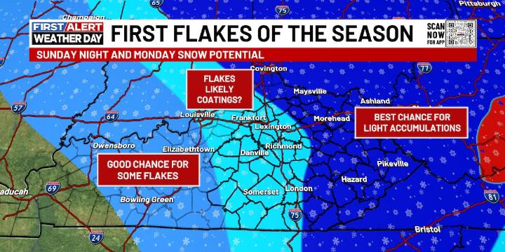
LEXINGTON, Ky. (WKYT) - A break in the action for our Saturday forecast - ahead of cooler temps and flurries pushing in on our Sunday.
Today across the Commonwealth, a mix of sun and clouds will bring temperatures into the upper 50s to middle 60s, making for a pleasant day despite a foggy start. Widespread dense fog is expected this morning, with visibilities dropping to less than a quarter mile in some areas. The fog will gradually lift and dissipate around mid-morning, but drivers should remain cautious during the early commute.
A strong cold front will sweep through the Ohio Valley tonight, bringing showers and possibly a rumble of thunder. Gusty winds will accompany the front, and temperatures will begin to crash from west to east as arctic air moves in. By Sunday, much colder weathe

 FOX19 NOW
 WCBD News 2
 KARK
KARK Courier Journal
 Click2Houston
 WOWT Crime
 Just Jared
 The Daily Beast
 AlterNet
 Major League Soccer