
 Hawaii News Now
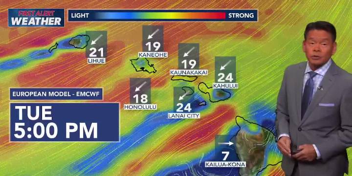
HONOLULU (HawaiiNewsNow) - Breezy to locally strong trade winds will persist for much of the coming week, with a First Alert for trades that trigger wind advisories for portions of the state around midweek.
The strong winds are following in the wake of a weakening frontal boundary that brought much-needed rainfall. Slightly drier and more stable conditions will build in over the next few days.
Forecast models are showing another area of moisture over the islands around Wednesday, with showers still favoring the usual windward and mauka areas.
A high surf advisory has been issued for the north-facing shores of most islands through 6 a.m. Tuesday for waves that could reach 18 feet. Another swell could come close to high surf advisory levels for north and west shores midweek.
East facing

 WSIL-TV
 KNOE
KNOE WBRC
WBRC FOX Weather
 The Bay City Times
 KOLO8
KOLO8 Reno Gazette-Journal
 NBC News
 CNN Climate
 Raw Story