
 21Alive News
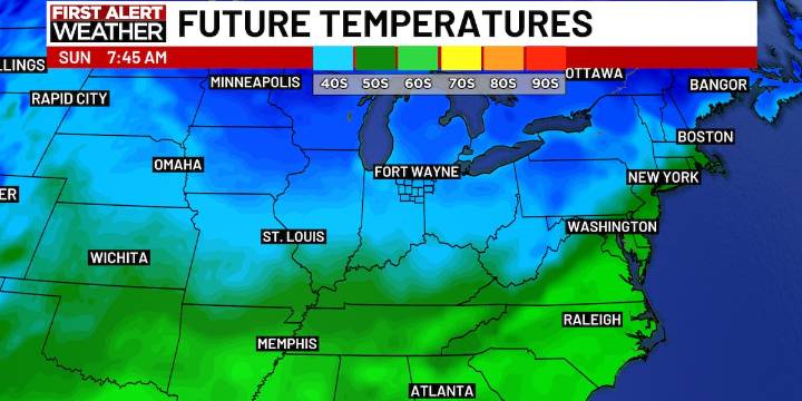
FORT WAYNE, Ind. (WPTA) - A cold front passes through late Saturday, which will drop temperatures for the second half of the weekend. Morning lows on Sunday will be in the mid 30s, and only climbing into the upper 40s. Morning lows will be in the low 30s through Thursday with afternoon highs in the low-to-mid 40s.
Tuesday will bring our next weather system, expected to bring some rain/snow mix early on Tuesday, but quickly switch to some hit-and-miss rain showers.
Another weather system is expected to move in late Thursday and pass through the area on Friday. At this time, specific details will come more into focus the closer we get, but we could be dealing with rain during Christmas on Broadway on Friday,

 Bozeman Daily Chronicle
 Reuters US Top