
 WRCB-TV
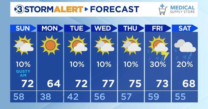
Happy Saturday, everyone!
Tonight will be warmer than it was this morning at 58 for the low with mostly clear skies. Wind gusts will continue to be between 15-30 mph overnight headed into Sunday with higher gusts in the mountains. Bring inside any loose objects from outdoors.
Sunday will be warm at 72 with mostly cloudy skies. Clouds will clear out throughout the day giving us sunny skies in the late afternoon. There is a slim chance for a light rain shower in our northeastern communities between 2:00 and 7:00 AM EST. The low will be colder at 38. Winds will decrease Sunday evening.
A cold front will move in Sunday afternoon which will give us cooler conditions headed into Monday. Monday's high will be 64 with sunny skies.
Our next chance for thunderstorms will be on Friday evening.
W

 West Kentucky Star
 Daily Voice
 NBC Connecticut
 Siskiyou Daily News
 FOX 11 California
 CBS Philly
 Denver7 News
 The Traverse City Record-Eagle
 The Daily Beast