
 Click2Houston
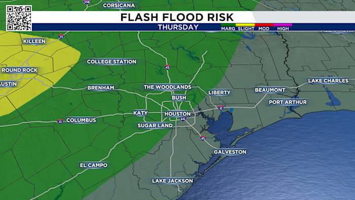
Tracking the Front:
We’re tracking a weakening cold front that will knock us back into seasonable temperatures next week with a solid chance for rain. The heaviest rain appears to stay across parts of the hill country and west of San Antonio, where there could be some measure of flash flooding.
While parts of central Texas will likely see the bulk of this rain, we will see some scattered storms move in early Friday across the Brazos Valley and look to weaken once they approach most of the Houston metro by Friday afternoon.
Right now, we’re tracking the chance for isolated strong thunderstorms with the possibility of localized heavy rainfall. We have a marginal risk, level 1 out of 5, for excessive rainfall north and northwest of the Houston metro area.
Your extended forecast:
Behind T

 DailyTrib.com
 KENS 5
 NBC News
 Pitchfork
 CNN Crime and Justice
 CNN
CNN KTRE 9 News
 KGNS
KGNS RadarOnline