
 Alabama News Network
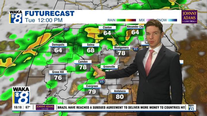
Saturday was a fairly cloudy but warm and humid day, with high temperatures in the upper 70s to low 80s. Isolated showers were in the mix throughout the day, in advance of a weak cold front located across the central part of Alabama. The front moves through our area overnight, resulting in cooler temperatures. Lows range from the low to mid 50s. Thanks to lingering humidity, areas of fog may develop through early Sunday morning.
Sunday becomes a mostly sunny and warm day, with highs in the mid to upper 70s. Sunday night lows range from the upper 40s to low 50s. Monday looks partly cloudy, warm, and dry with highs in the upper 70s. Rain and storms return Tuesday in advance of our next cold front. Rain/storms linger into Tuesday night, but likely depart early Wednesday as the front moves th

 America News
 Associated Press US and World News Video
 KSNB Local4 Central Nebraska
 KXLY 4 News
 WKOW 27
 The Spectator
 Fit&Well
 Wrestling News