
 Syrancuse.com
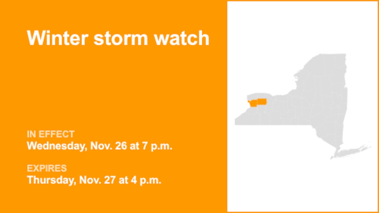
On Monday at 12:40 p.m. the National Weather Service issued a winter storm watch valid from Wednesday 7 p.m. until Thursday 4 p.m. for Northern Erie and Genesee County.
"Heavy lake effect snow possible. Total snow accumulations 7 inches or more possible in the most persistent lake snows. Winds could gust as high as 50 mph, producing considerable blowing and drifting snow and near whiteout conditions," adds the weather service. "There remains considerable uncertainty during the early portion of this lake effect snow event. There remains some uncertainty with band placement, and considerable uncertainty with how fast lake effect rain will change to snow. Both of these factors will determine how much snow ends up accumulating."
"Travel could be difficult with slushy, snow covered roads and

 YourErie
 Lehigh Valley Live
 The Bay City Times
 Daily Voice
 Sault Ste.Marie Evening News
 WCBI-TV
 WAFB
WAFB Jackson Citizen Patriot
 KPLC
KPLC Roll Call
 CNN
CNN