
 13 On Your Side
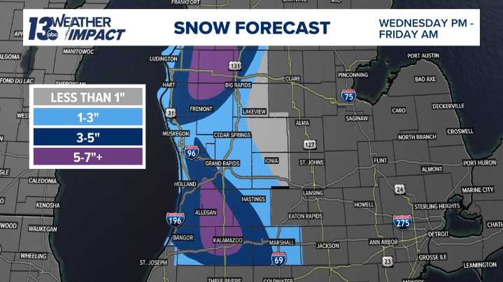
GRAND RAPIDS, Mich. — If you’re traveling for Thanksgiving, be prepared, as isolated portions of West Michigan are gearing up for hazardous lake-effect snow, while other areas may enjoy relatively smooth sailing conditions. The highest impacts are expected along the I-94 corridor and up along US-10, where 5 to 7 inches of snow could fall from Wednesday evening through Thanksgiving Day.
A strengthening low-pressure system arrives Wednesday morning, bringing rain and strong winds to kick off the holiday travel period. As winds shift to the northwest on Wednesday afternoon, temperatures will drop sharply, and rain will transition to snow. This change will trigger lake-enhanced snowfall across our northwest snowbelts.
Wind Advisories are likely, especially along the lakeshore, where gusts co

 USA TODAY National
 WLKY
WLKY Lansing State Journal
 People Top Story
 Newsweek Top
 America News
 The Hill
 Associated Press US News
 The List