
 The Bay City Times
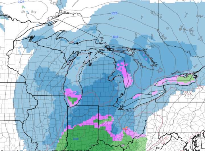
While it’s still far enough out in time for significant changes to the forecast, a more widespread storm system is already consistently showing up in our weather forecast data.
The storm system already looks quite impressive on the current satellite image over the Pacific Northwest.
This next storm system looks medium in strength and medium in moisture amounts. The difference between our Thanksgiving storm and the next one is the possibly farther south track of the storm center, and the more widespread coverage of the snow.
The projected track now, through Illinois, Indiana and Ohio, would put the steady snow area across the southern half of Lower Michigan.
Here’s the surface weather forecast from Saturday morning to very early Monday. Notice the snow area is not a banded look like lak

 People Top Story
 Newsweek Top
 America News
 Associated Press US News
 The Hill
 The List