
 WAND TV
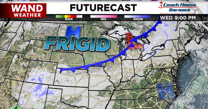
DECATUR, IL. (WAND) - Happy Wednesday! Our mildest day this week and coldest night of the season arrives today.
A cold front rolls in today with more clouds by the midday and a few, isolated, light snow showers this afternoon. These snowflakes will be low-impact and short-lived with little to no accumulation not expected. However, the front will bring major impacts on our temperatures starting tonight.
While we get to the low 30s during the day, temperatures dive into the single digits tonight behind the front. When you add in the wind picking up today and tonight, we can expect wind chill values in the 20s today and negatives and near 0 overnight.
These wind chills in the negatives are expected to persist from Thursday morning and Friday morning.

 KFDA-TV
 WTKR
WTKR 21Alive News
 Akron Beacon Journal
 Local News in New Jersey
 Daily Voice
 Associated Press US and World News Video
 The radio station 99.5 The Apple
 NBC 7 San Diego Local
 KSNB Local4 Central Nebraska
 IndyStar
 CNN Climate
 The Oregonian Public Safety
 The Conversation