
 Peoria Independent
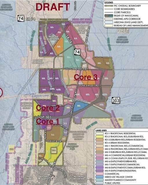
Peoria has launched a new website that serves as a one-stop information resource related to land planning and entitlement efforts for the 7,000-acres of undeveloped State Trust Land, known as the Peoria Innovation Core.
The PIC is within the city of Peoria and generally located east of the Agua Fria River and extending from Lone Mountain Road to State Route 74.
A visit to www.PICPeoriaAz.com includes all planning maps and descriptive land uses for all three Core areas of the PIC. Core 1 includes land from Lone Mountain Parkway to Loop 303. Core 2 encompasses the area from Loop 303 to the CAP Canal, and Core 3 traverses the CAP Canal, north to SR74.
Land planning efforts are now underway for this 10.5 square miles of land.
The proposed land use types would be the basis for the zonin

 KOLD Tucson
 Arizona's Family
 Raw Story
 Mesa Independent
 Tucson News Now
 AlterNet
 Tribune Chronicle