
 IFL Science
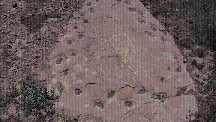
One of the longest trackways created by a single dinosaur shows it completing a full loop. Drones have been used to map all 95 meters (315 feet) of the footprints, which show some intriguing behavior, but don’t tell us what made the sauropod change its mind on where it was going. The rest of this article is behind a paywall. Please sign in or subscribe to access the full content.
At West Gold Hill, Colorado, a set of at least 131 sauropod prints have been known since at least the 1950s. The previously private land was acquired by the US Forest Service last year, and paleontologists have since used drones to map the path in a way that is hard to do from the ground. The almost 360° change in direction the drones revealed may tell us a sauropod’s turning circle, among other aspects of the

 NBC News
 @MSNBC Video
 WBAL-TV 11 Baltimore Covid-19
 Detroit Free Press
 New York Post
 America News
 Atlanta Black Star Entertainment
 Courier Post Sports
 Raw Story