
 The Conversation
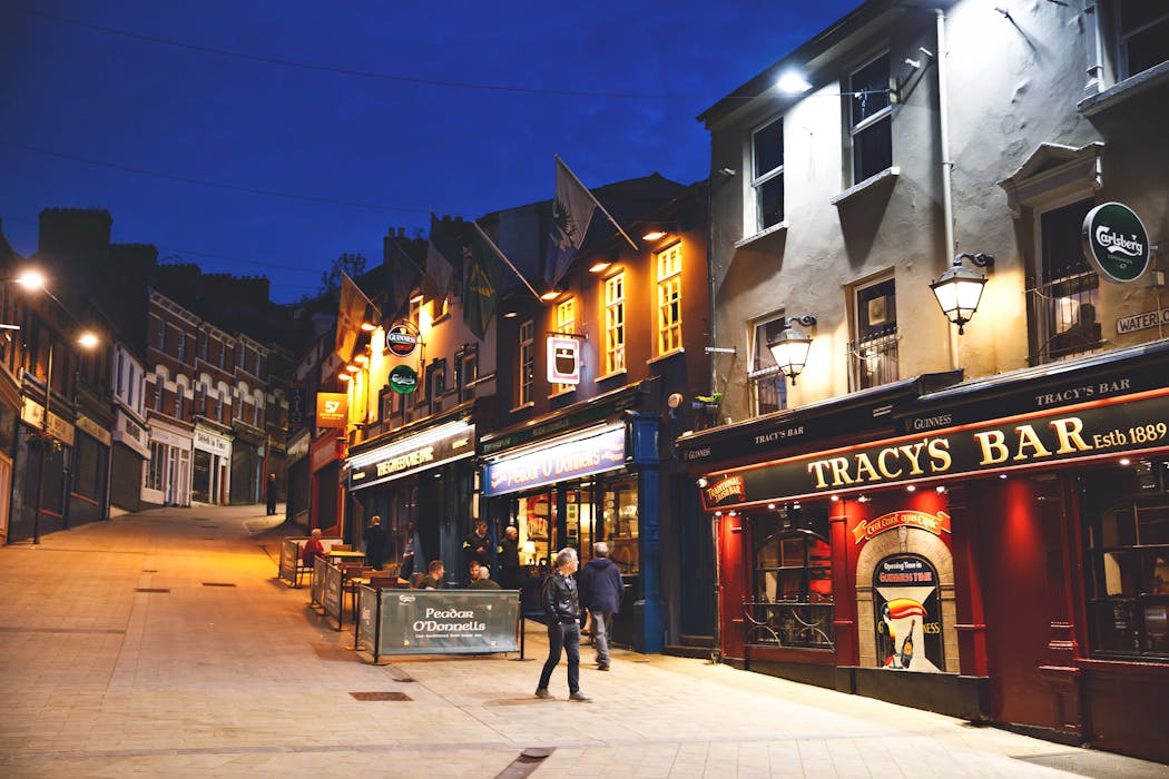
In the historic walled city of Derry (also known as Londonderry) in Northern Ireland, the night-time economy is vibrant. But like many urban centres, it presents safety challenges for those trying to get home. At night, a volunteer group known as the Inner City Assistance Team (iCat) often patrols the streets, intervening when people feel vulnerable – whether due to intoxication, a mental health issue, or simply being alone in unlit or unfamiliar areas.
Recently in the city, iCat introduced Safest Way, a pedestrian navigation app I co-developed during my PhD research at UCL. The app employs AI technology to show users not just faster but safer routes when walking to and from a destination – for example, the safest way home after a night out.
The necessity for such interventions is rooted in a stark disparity in how urban safety is experienced by women and men.
Research by the Office for National Statistics in 2022 found that 82% of women feel unsafe walking alone in parks or open spaces after dark, compared with 42% of men. And 63% of women actively avoid travelling alone when it is dark, against 34% of men.
A survey by Plan International UK in 2024 found that nearly three-quarters of girls and young women (ages 14-21) sometimes choose longer routes home to avoid potential danger, and almost two-thirds take taxis home at least once a month because of the risks associated with public transport or walking.
Such fears are a direct response to the built environment, with research showing that factors such as street lighting and conditions of pavements are key aspects of how safe women feel . Lighting is often the deciding factor: 60% of women who feel unsafe walking to and from public transport cite poor lighting as the primary reason.

Bridging the data gap
For decades, urban walkers have been treated like vehicles, with mapping tools optimising routes for a single metric – travel time – while treating a dark alley and a high street as identical, if the distance is the same. The question of feeling safe has been largely overlooked by this technology.
Part of the reason for this has been a lack of unified data. While local authorities and police forces collect vast amounts of information regarding street lighting, CCTV locations and crime incidents, this data is typically fragmented, incompatible or locked in static PDFs.
To bridge this gap, my team and I developed a data pipeline to aggregate these and other sources. In London, this required issuing dozens of freedom of information requests to borough councils to obtain precise geospatial data on over half a million street lights and thousands of public CCTV cameras. Our lighting map was awarded first prize in the 2025 UCL data visualisation competition.
We then combined this information with official police crime datasets, urban features such as the location of parks, industrial areas and run-down buildings, plus open-source Mapillary and OpenStreetMap data to “safety score” individual street segments.
Even then, objective data is only half the picture. Perceived safety – how safe a street feels to someone walking it – is critical to the route choices they make. To model this at scale, we turned to Artificial Intelligence: specifically, OpenAI’s vision-language model Clip (Contrastive Language-Image Pre-Training).
Unlike traditional computer vision that detects discrete objects such as street lamps, Clip (and similar vision-language models) encodes the semantic meaning of an entire scene – converting both visual data and user-provided text prompts into mathematical vectors.
Classifying subjective viewpoints such as “feels safe” or “quite risky” is an ongoing area of research. But in our 2025 study, we found a high correlation between the way AI and our human testers perceived safety, based on 500 photographs of London street segments.
While we now hope to scale this approach to modelling urban safety to millions of streets in the UK and beyond, we are realistic about the limitations. Past crime and urban design data can inform safer choices, but they cannot predict individual incidents. Our model is designed to support decision-making not guarantee safety, and it should sit alongside wider efforts by venues, councils and police to make night-time streets safer.
Derry’s early adoption
Since launching its beta version, the Safest Way app has been adopted by approximately 1,000 users, primarily in London and Derry, where most of the safety infrastructure is fully mapped.
Coordinating the Derry launch from afar was a challenge. A Safest Way team member visited the city early in 2025 to learn about the city’s complex political landscape firsthand. But the pilot’s success was made possible largely thanks to our partners, iCat.
The volunteer group’s co-founder, Stephen Henry, told the Irish News that the idea to bring the app to the city had come about following some attacks on women there in 2024.
The group now distributes beer mats with Safest Way logos and QR codes in local pubs. “We encourage staff to download the app too,” Henry points out, “as they often don’t leave the premises until 3am or later”.
Having recently showcased our technology at the Prototypes for Humanity conference in Dubai, we are now scaling the app’s data coverage – from street lighting to AI-modelled perception of safety – to cover all of England and then the rest of the UK. We aim to close the information gap that currently forces vulnerable groups to pay a safety tax.
In Derry, the technology already provides a digital layer of protection that complements the physical presence of volunteers. By including this tech in their vulnerability training for security staff and using it during their patrols, iCat is moving beyond reactive assistance to proactive risk reduction.
This article was commissioned in conjunction with Prototypes for Humanity, a global initiative that showcases and accelerates academic innovation to solve social and environmental challenges. The Conversation is the media partner of Prototypes for Humanity 2025.
This article is republished from The Conversation, a nonprofit, independent news organization bringing you facts and trustworthy analysis to help you make sense of our complex world. It was written by: Ilya Ilyankou, UCL
Read more:
- AI-driven CCTV upgrades are coming to the ‘world’s most watched’ streets – will they make Britain safer?
- How can we make the world’s cities safer for women and girls?
- Sexism and the city: how urban planning has failed women
Ilya Ilyankou receives PhD funding from the UKRI's Engineering and Physical Sciences Research Council and Ordnance Survey. He is a co-founder and chief technology officer of Safest Way, a startup supported by the Ordnance Survey’s Geovation accelerator programme. This article was commissioned in conjunction with Prototypes for Humanity, a global initiative that showcases and accelerates academic innovation to solve social and environmental challenges. The Conversation is the media partner of Prototypes for Humanity 2025.


 Newsweek Top
 The radio station 99.5 The Apple
 New York Post
 K2 Radio Local
 NHL Arizona Coyotes
 Raw Story
 The Daily Beast