
 21Alive News
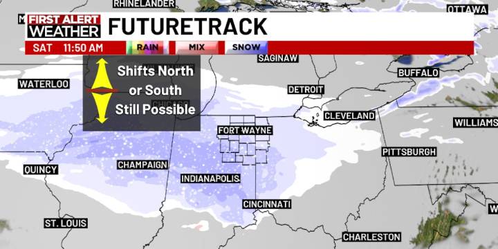
FORT WAYNE, Ind. (WPTA) - The first of two clipper systems continues to skate through the Ohio Valley this evening, painting a swath of 2-4″ of snow across Central Illinois and Indiana. For us up north, flurries are as much as we can expect!
The second clipper system is still expected to move in slightly farther north compared to the first, but the heaviest snow will continue to be concentrated across Central Indiana. For Northeast Indiana and Northwest Ohio, a general trace to an inch of snow can be expected from late morning through midnight Saturday, with the best chance of seeing an inch or so south of Fort Wayne. Highs will be cold, settling into the low 20s.
Sunday morning looks particularly frigid with wind chills near -10º, followed by highs in the upper teens to low 20s. A Fir

 AlterNet
 Iron Mountain Daily Life
 Raw Story