
 cleveland.com
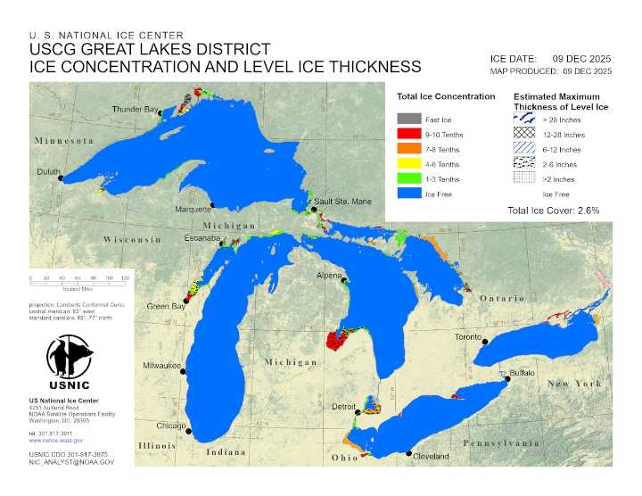
CLEVELAND, Ohio — Winter is beginning to leave its first fingerprints on Lake Erie.
Some ice has formed along the lake’s western edge, though federal scientists say these patches represent only the earliest stages of freeze-up, not the onset of lakewide ice.
The latest ice map from the U.S. National Ice Center shows ice along the western shoreline, including in Maumee Bay and Sandusky Bay — areas that often freeze earlier because the western basin and the bay is shallower than the rest of the lake.
The localized ice follows several days of below-normal temperatures and can be seen on a live cam at Crane Creek in Ottawa National Wildlife Refuge.
According to the National Oceanic and Atmospheric Administration’s Great Lakes Environmental Research Laboratory , ice covered about 1.

 Cleveland 19 News Crime
 The Federick News-Post
 5 On Your Side Sports
 NBC News
 Raw Story
 America News
 ESPN Cricket Headlines
 Atlanta Black Star Entertainment
 The List