
 ABC57 News
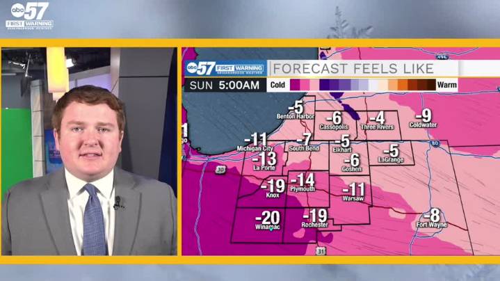
To view this video please enable JavaScript, and consider upgrading to a web browser that supports HTML5 video
Saturday starts off average in the mid 20s with mostly cloudy skies overhead. As an impulsive system passes south of Michiana, snow showers start up but stay mainly contained to along and south of US-30 in the afternoon and early evening, producing about 1-3 inches in these areas. After a brief weakening of snow from roughly 7-10 PM EST, shifting winds follow the surface low's passage and help create a conducive environment for lake effect snow tonight and tomorrow morning. Those not under the lake effect must deal with dangerously cold wind chill values in the negative double digits late tonight. Snow wraps up mostly by noon tomorrow, depositing another 1-3 inches in counties f

 The Times Herald
 WDEL
WDEL WREX
WREX WEIS Radio
 Deadline Detroit
 The Bay City Times
 13 On Your Side
 The Grand Rapids Press
 Detroit News
 Associated Press Top News
 Raw Story