
 KOAA News5
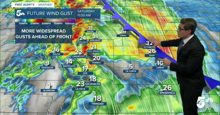
Today’s Forecast:
The winds have us rocking and rolling this morning in parts of southern Colorado - mainly areas west of I-25, higher elevation zones like the Palmer Ridge, and gap flow zones such as Huerfano county. This is the latest in a long string of downslope wind day set ups over the last couple weeks. That downslope breezes increase through this morning, and will remain strongest west of I-25 (to 35-40 mph), and in the Black Forest area. Temperatures are climbing quickly due to the downslope compressional warming and that trend will continue until around noon today. By then, you'll see temperatures in the upper 50s, to lower 60s along most of the plains - with some mid-60s in lower elevation zones.
In what has become a familiar pattern over the last several days, a backdoor cold

 NECN Providence
 ABC6 Rhode Island
 NBC Connecticut
 Siskiyou Daily News
 The Oregonian Public Safety
 WAND TV
 MyNorthwest
 WMTV NBC15