
 KIMT News 3
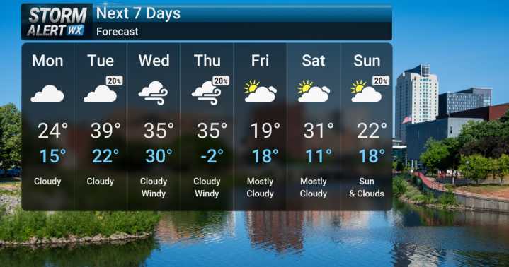
We've been in the grip of truly bitter cold, with apparent temperatures dipping well below zero even during the day. That deep chill is finally starting to loosen its grip. We're expecting a noticeable warming trend as we move through the early part of the week. By Tuesday, we'll be looking at surface temperatures climbing above freezing, which will be a welcome change from the frigid air we've endured.
However, as we look towards the middle of the week, our attention shifts to potential precipitation. By Wednesday night, our models are indicating the possibility of mixed precipitation, moving from rain initially, but then potentially switching over to some snow or a mix through Thursday. Winds will also be quite gusty. More details in the coming days.

 News Channel 36
 WLFI News 18
 WREX
WREX 7News Boston WHDH
 WAKA Action 8 News
 WCJB-TV20
 WCVB-TV Boston
 The radio station 99.5 The Apple
 WSIL-TV
 Butler Eagle
 The Washington Post
 WISC-TV Channel 3000
 CBC News World