
 ABC4 News
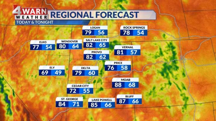
SALT LAKE CITY (ABC4) — An area of high pressure to our east will continue to bring moisture into the Beehive state over the next several days. This will bring widespread rain chances to the state along with decreasing temperatures.
Happy Tuesday, Utah! A disturbance is working up from southern Utah through northern Utah, bringing widespread showers & a few storms to the state. The more widespread coverage and intensity of these showers and storms could lead to a slightly higher chance for flash flooding across parts of Utah.
A Flood Watch has been issued for most of southern and central Utah through late Tuesday evening. High temperatures will remain well-below average due to the extra clouds and rain chances. Highs will only be in the low to mid 80s for northern Utah, with mid to upper

 KSL NewsRadio
 Essentiallysports Football
 The Daily Beast
 America News
 Essentiallysports Tennis
 Raw Story
 Essentiallysports Combat Sports
 New York Post